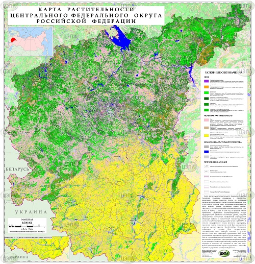
Vegetation mapping of terrestrial ecosystems at the regional level
_
Vegetation mapping is one of the priorities for remote monitoring of condition and dynamics of forest ecosystems. These products provide the basis for the assessment, geospatial analysis and modeling of the taxa forest characteristics, biodiversity, ecosystem functions and services. We have developed an integrated automated methodology of regional vegetation mapping…