")
Geographic information system of forest fires monitoring (GIS ISDM-FFA)
As part of the Information System of remote monitoring of forest fires (ISDM-FFA) geo-information system is built and operated that provides user operational information on current fires on land, air and satellite data, thunderstorm activity and meteorological observations (Ershov et al., 2010). The main purpose of the use of GIS in ISDM-FFA is the […]

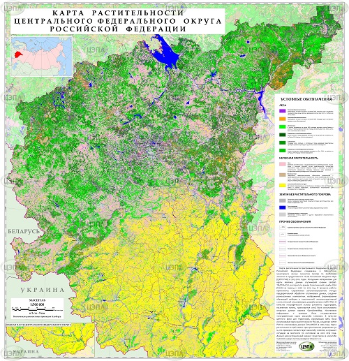
Typologic diversity of the forests of European Russia
Typologic diversity of the forests of European Russia (data base “Cenotic fund of the forests of European Russia”). The realization of the project is aimed at the classification of forest communities which can be applied to a big region and based both on traditions of Russian forest phytocoenoogy and contemporary approaches to plant communities classification. The […]

Estimation of forest taxation characteristics using satellite and ground data approach
High-resolution satellite images are used in determining the stock volume of stem wood, the height and age of coniferous and hardwood forests. A method was developed to restore the regression dependencies between the spectral brightness of the red channel (winter images) and some taxation characteristics of forest inventory materials (Sochilova, Ershov, Surkov 2012, 2013,2018).
National state forest inventory of Russia approach
The report of developing science and methodology supporting of improvement of national state forest inventory of Russia is presented (On Russian). The Natural Resource Ministry of Russia was a customer. There were three stages of project works. At the first stage, we analyzed status, problems and perspectives of the state forest inventory of Russia. […]