Geographic information system of forest fires monitoring (GIS ISDM-FFA)
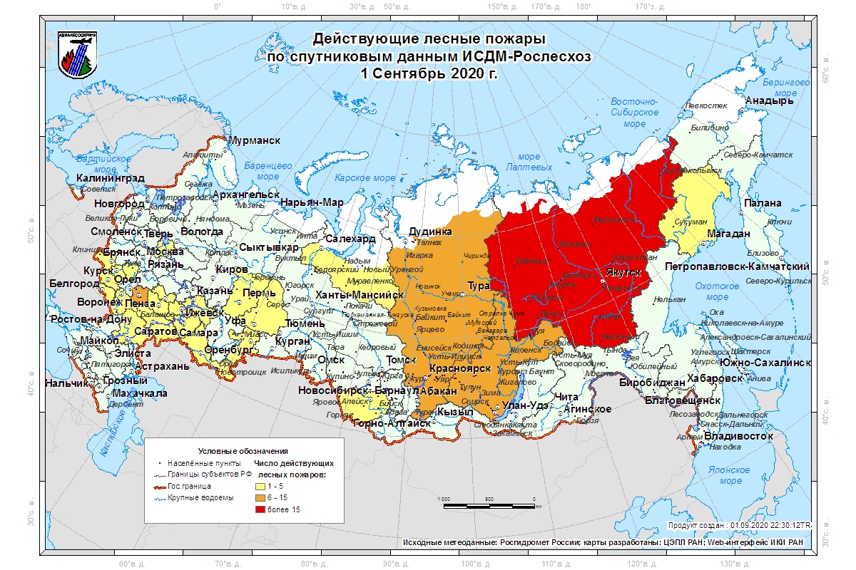
As part of the Information System of remote monitoring of forest fires (ISDM-FFA) geo-information system is built and operated that provides user operational information on current fires on land, air and satellite data, thunderstorm activity and meteorological observations (Ershov et al., 2010).
The main purpose of the use of GIS in ISDM-FFA is the integration of geographic information in a single environment, various kinds of data for rapid assessment of the situation and fire control, including:
- Аdoption of strategic and tactical management decisions for the transfer of the federal forces and resources to the regions to combat forest fires in conditions of extreme fire danger;
- The control regional states transferred powers in the field of forest relations in terms of the protection of forests against fires;
- Statistical reports on the completion of the fire season.
To achieve the above objectives GIS implements two ways of working with information ISDM-FFA:
- Daily preparation of cartographic products operating in automatic mode;
- Interactive work with data in a geographic information medium controllers and operatives of “Avialesookhrana” Federal Institution.
As main software tool is suite of products is used that developed by the Institute of Environmental Studies (Environmental Systems Research Institute Inc., ESRI).
Preparing operational cartographic products
Everyday information products are automatically generated and sent to ISDM FFA server. To this end, a program complex MAPGENERATOR, which makes a request to a single database at a specified time in order to obtain the desired characteristics for the construction of thematic maps. Then follows spatial analysis of data within the ArcGIS environment, preparation of standard cards from templates and send them to the storage of finished products ISDM information. As soon as the products enter the store, they will automatically become available on the WEB system servers.
For this scheme to create a map of foci of large forest fires (more than 25 hectares for the European part of Russia and more than 200 hectares in Siberia), “active forest fires”, “increase in area burned per day” and “new forest fires.” This information is based on daily reporting data from the subjects of the Russian Federation, as well as on the results of space monitoring.

In addition, it formed about 360 cartographic products based on the Russian weather service data (Roshydromet) and ground-based lightning detection system “Avialesookhrana”. It is composed of actual and forecast figures nightly and daily precipitation, maximum temperature, fire danger classes on techniques VG Nesteroff, PV-1 and PV-2 and “thunder hazard rate” (density of the lightning with positive amplitude), the risk of forest fires. These maps are created for the entire territory of the forest fund of Russia, and at the level of federal districts or individual subjects.

Interactive work with data ISDM-FFA
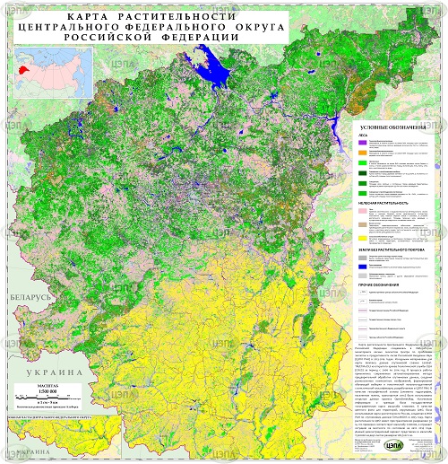
Besides GIS technology automatic preparation of standard cartographic products provided the use of a desktop GIS for interactive work with operational information about fires, information available on the servers ISDM FFA. For this task, use desktop GIS based on ArcGIS 9, functionally adapted to work with databases ISDM FFA.
The GIS remote access to a single database ISDM FFA data. At the first you get into the working window of geographic information system set of map layers by forming a rectangular area on the map, geographic coordinates by limiting the monitoring area. Further, through the dialog box are given the opportunity to determine the time interval and the composition of the information of interest. After starting the module on the screen is updated map layers with operational information on fires, thunderstorms and meteorological observations in the form of point, line and polygon features.

Visualization of satellite images in GIS is implemented by dynamic data from the server swap prepare raster ISDM products. Established technology allows the user to move around the map, while loading an image. Depending on the web speed delay may range from 5 to 30 seconds. The advantage of this approach is the possibility of obtaining satellite images of the same size, regardless of the size of the requested area. This is achieved by changing the resolution of the requested image, calculated taking into account the scale of the map screen. GIS server transmits information via the HTTP protocol on the geographical coordinates, image size and resolution. According to the set parameters of preparation of satellite server product forms required the user to raster GIS product and sends a link to download. For images of high spatial resolution provides the option to view the scenes without image processing circuits for preliminary search of the required set of data on the area of interest.

Geographic information system is also provided with the ability to display thematic information on fires, lightning and data of meteorological observations in an integrated manner (eg, fire card: date of detection, area, geographic location, subject, forestry, etc.) To generate a standard reporting analytical forms ISDM FFA in Microsoft Excel format.

The GIS module also works with a set of tools designed to provide information support for conducting field measurements of areas of major forest fires by land and air way. At the preparatory stage with the help of expert receives requests GIS circuit burning generated image processing algorithms medium resolution Modis satellite image and a high resolution (eg, Landsat). With burning contour refinement tool for high-resolution images generated detailed outline estimated area, perimeter, and other necessary characteristics.

If you have a GIS map information on the distribution of forest and wooded areas on burning before the fire, are calculated according to their area. The result can be stored in ArcGIS formats (shapefile) or exported to GPS receivers format (the NMEA standard). The module also allows you to work in ArcGIS in real time with the GPS receiver such as the GARMIN (model “Garmin Extrex Vista C”) with the ability to display and store circuits (tracks), and of polygons in shapefile format. Finally the prepared material is used for field surveys and aviaobletov burnt areas for the purpose of verification and assessment of areas damaged by fire forest vegetation.
GIS also has the ability to analyze the dynamics of large-scale forest fires and identify its causes and uncontrolled spread. To do this, create a tool that allows you to view and analyze data about the fire; Displays the status of the fire at any particular date, and visualize data about the fire in the form of tables and three-dimensional histogram. Furthermore, it is possible to form a reporting forms Excel spreadsheet format, and provides a convenient ArcGIS interaction with the application.

The latest version of GIS ISDM an opportunity to manually enter individual objects and their analysis with available information on fires.
You also have the possibility of constructing a continuous field of thunderstorm activity cards in the previous five days. To do this, use the optional extension module ArcGIS Spatial Analyst is an aid for providing advanced capabilities for modeling and analysis of raster data. By clicking on the tool button, select the construction of maps zone posrerastryanuv occurs prior display a dialog box that allows you to specify the date of the request.
Start button initiates the download from the server ISDM actual lightning detection data by the specified number, plus the previous five days. Based on these data, existing in the form of discrete points, in the future construction of a successive raster maps the distribution density of lightning discharges in the ESRI format Grid.V when working in ArcMap document there is a group layer “lightning discharge”, the contents of the group layer is updated with the new set of generated maps. Otherwise, a new group layer “lightning discharge”, which is copied to a new set of result cards.

Also developed a tool that provides the ability to form the five key reports of burning of forests using satellite data preserving them in Microsoft Excel format:
- Statement of forest fires on the territory of the forest fund (1 ISDM).
- Operational report on forest fires in unprotected areas of forest fund according to the comic monitoring (2-ISDM).
- Report on forest fire number ___ (in comic monitoring area) (3 ISDM).
- A summary report on forest fires in the protected areas of forest, according to satellite monitoring data as of “_” ________ * 200 g (4-ISDM).
- Comparative statement of large forest fires (5 ISDM).
Researchers: Dmitrii Ershov, Konstantin Kovganko, Pavel Shulyak


